
Pilot Tasks
Find ideas. Challenge yourself.


Flying cross country is the hallmark of Midwest Hang Gliding. To make your flight safe and enjoyable, in addition to your regular preflight activities, we encourage you to
- Properly plan your flight
- Always fly with a buddy
- Carry a radio or cell phone and a bottle of water
- Bring your glider bag
- Always be aware of landing area possibilities. If you cannot make it back to the airport, find locations with low crops, no power lines, and near a road or intersection, so that you are easier to find.
- Know the weather for the day – both where you are and where you plan on going
- Make your glider visible - examples include reflective streamers, disco ball, etc.
- Know your airspace – around the airport and where you are going
- Bring a chase driver
- Practice your spot landings
Hang gliders in the Midwest are normally between 2,000’ and 6,000’ AGL. This is a range where you can expect to see general aviation traffic. Around HGC are many other airports, private and public. Be aware of airspace to avoid legally and airspace to avoid for your safety. Kankakee Regional Airport (KIKK) is the closest public airport to Enjoy Field. Keep in mind that the approach path for Kankakee’s runway is miles south almost in line with Highway 57. Use caution when flying over highway 57 to avoid incoming traffic to Kankakee. Glider pilots must avoid all populated areas.
The below tasks are provided for informational purposes only. Only you, as the pilot, can make decisions about your flights.
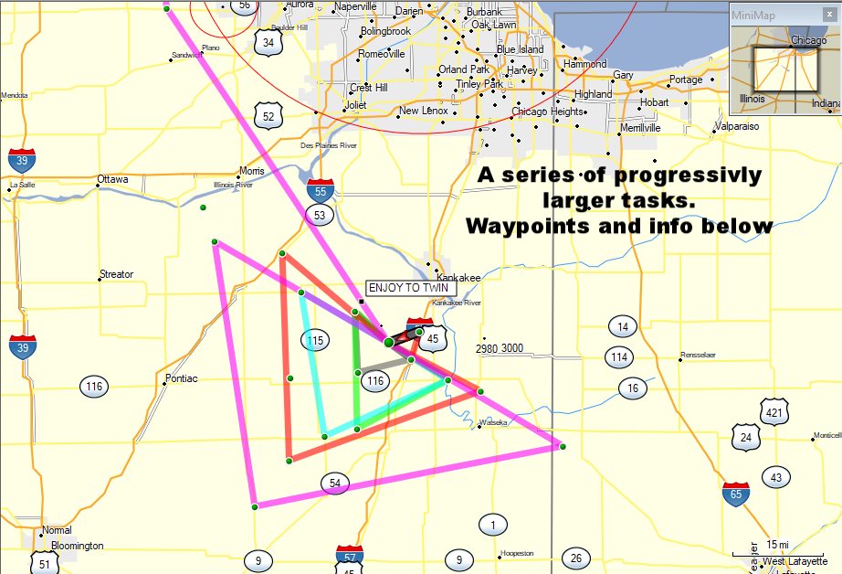
Here are BIG tasks that keep you close to the field
Waypoint file for download below
Enjoy - Chebanse - Clifton - Enjoy

15 miles and you only really need the Enjoy waypoint, as you can see the 2 towns!
ENJOY N40°58.496 W87°59.838
Chebanse N41°00.276 W87°54.084
CLIFTON N40°56.200 W87°55.890
ENJOY N40°58.496 W87°59.838
Enjoy -Clifton - SW Quary - Herscher - Enjoy
ENJOY N40°58.496 W87°59.838
CLIFTON N40°56.200 W87°55.890
SWQUARRY N40°54.324 W88°05.151
HERSCHER N41°03.025 W88°05.674
ENJOY N40°58.496 W87°59.838

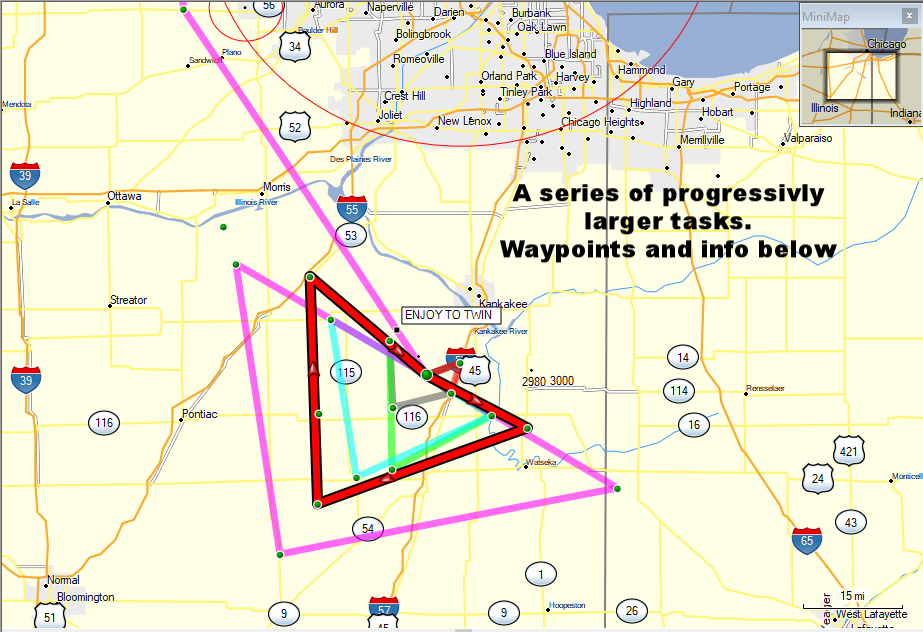
A 30 mile triangle and you're never 7 miles from the field!
Le'Erable - LaHogue - Herscher Triangle

A 50 miler and you're never 15 miles away.
ENJOY N40°58.496 W87°59.838
LERABLE N40°53.261 W87°49.482
LAHOGUE N40°46.298 W88°05.303
HERSCHER N41°03.025 W88°05.674
ENJOY N40°58.496 W87°59.838
Enjoy - L'Erable - Piper City - Reddick - Enjoy
ENJOY N40°58.496 W87°59.838
LERABLE N40°53.261 W87°49.482
PIPER CITY N40°45.227 W88°10.947
REDDICK N41°05.785 W88°15.026
ENJOY N40°58.496 W87°59.838

70 miles
Enjoy - Pittwood - Cereal - Gardner - Enjoy

100 miles
ENJOY N40°58.496 W87°59.838
PITTWOOD N40°51.654 W87°43.797
CEREAL N40°41.766 W88°17.127
GARDNER N41°11.347 W88°18.322
ENJOY N40°58.496 W87°59.838
Enjoy - Raub - Sibley - Verona - Enjoy
ENJOY N40°58.496 W87°59.838
RAUB N40°43.826 W87°29.501
SIBLEY N40°35.216 W88°23.101
VERONA N41°12.995 W88°30.104
ENJOY N40°58.496 W87°59.838
The most challenging task we're presenting. From a small beginning, a few miles out-and-back, this is what an XC pilot aspires to!

150 miles - this is record territory! - best of the best
Enjoy - TwinOaks - Visit our brothers in Wisconsin!

Enjoy - TwinOaks - thread the airspace - Hinkley is KEY! (140 miles)
ENJOY N40°58.496 W87°59.838
HINCKL N41°46.160 W88°38.427
TWINOAKS N42°50.965 W88°45.595
If there is a nice south breeze, this is fun. Fly to the flight park north of us in Whitewater, WI.
Hinckley is the key. It is west of the O'Hare/Aurora airspace and east of the Rockford airspace.
A task for only a few days a year, but an accomplishment!
Now, How about those Waypoints?
GpsDump is a program that helps get waypoints on and off your Flight instrument. Also some GPS's directly read these files. Click here to DOWNLOAD GpsDump.
Download the file with those waypoints here.
Some of us like to "GET HIGH and GO FAR!" There is the opportunity to learn much (pilot skills, airspace, navigation, weather, etc. ), have fun, and tell many campfire stories...